ULTRA ROUTE

The Ultimate Gralloch Challenge
Across the Wild HEART of Galloway
Set against the vast landscape of the Galloway Forest Park and the hills of East & Southern Ayrshire, the Genesis Gralloch Ultra presented by Maxxis is 323 kilometres of semi-supported ultra-distance riding through some of the most varied and remote terrain in Scotland.
From the quiet streets of Gatehouse of Fleet in the early morning hours to the standing arches of the Big Water of Fleet Viaduct at the close, the route moves through private estates, renewable energy landscapes, ancient forest and open Galloway glens. It is a long, demanding and deeply rewarding day in the saddle.
The route includes open-road sections. Riders must remain alert and follow road safety rules and the Highway Code at all times.
323km
4,819m
What's in store
323 kilometres and 4,819 metres of climbing through the wild interior of Southern Scotland. Private estates, renewable energy landscapes, remote forest and ancient glen: the route covers ground that most riders will never otherwise see. This is semi-supported ultra-distance riding at its most demanding and most rewarding.
Into the Forest: The Opening Gambit. KM 0–58
The Genesis Gralloch Ultra presented by Maxxis begins before the town of Gatehouse of Fleet has fully woken. Roll out along Laurieston Road in the early morning quiet, the Solway Firth opening behind you as the climb begins. On a clear day, a glance over your shoulder might reveal the Isle of Man on the horizon. Hold that image. It will feel a long way away by the time you finish.
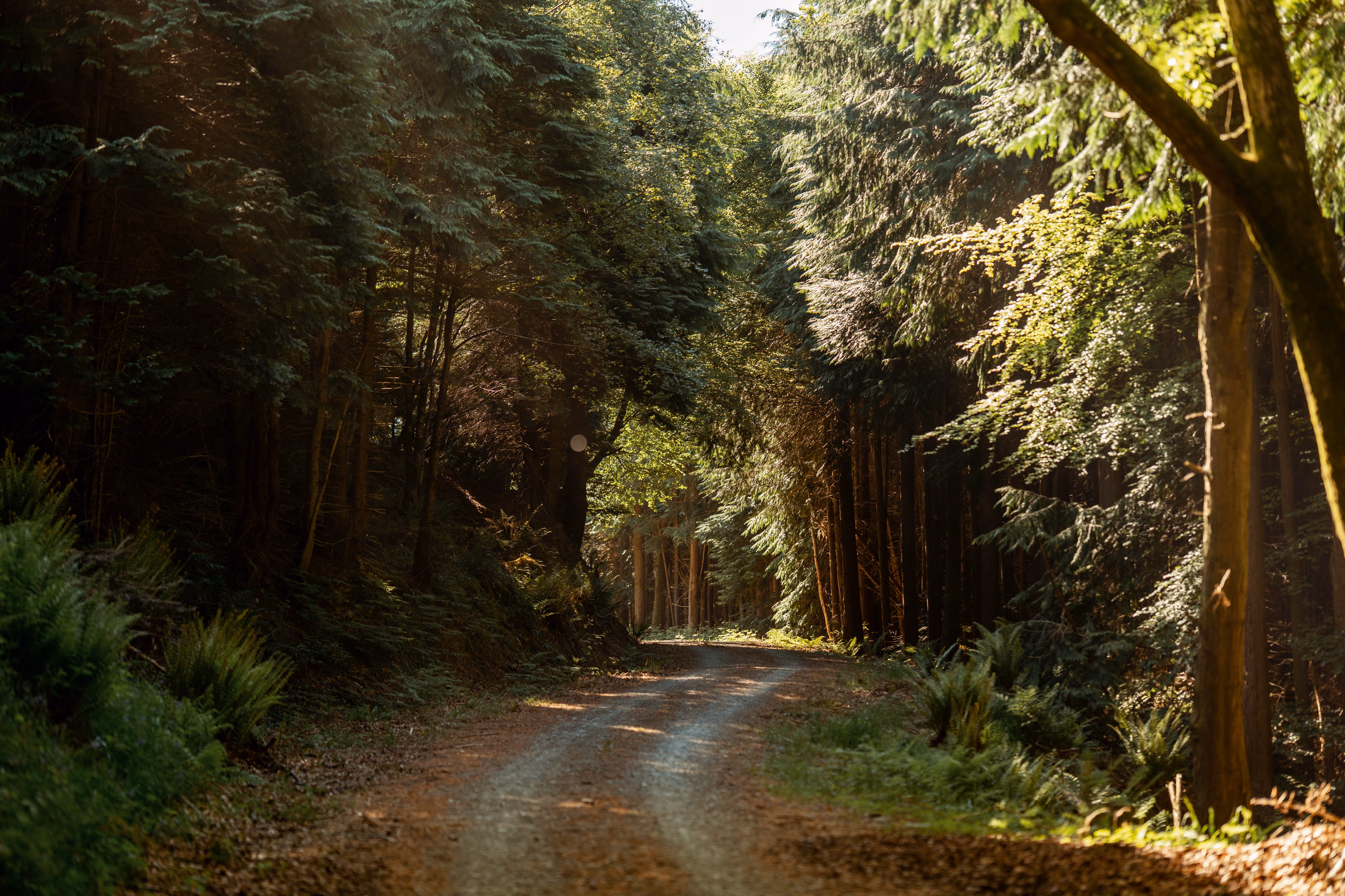
The gravel arrives early, with punchy climbs dropping straight into the Galloway Forest Park. Much of this section traces the UCI Race route, past Loch Skerrow, Stroan Loch, and up Slaughter Hill before the descent delivers you onto the famous Raiders Road Forest Drive. Champagne gravel runs alongside the river, past Otter Pool, and out to The Queen's Way.
From here the route shifts onto quiet countryside roads, winding past Glenlee and skirting St John's Town of Dalry, before climbing Knocksheen Glen towards the first great estate of the journey.
Into the Bowl: Forrest Estate and the Galloway Hills. KM 59–105
Leaving the public road behind, you enter Forrest Estate: a vast, serene private landholding nestled in the hills above St John's Town of Dalry. The Galloway Hills begin to tower on all sides, the landscape closing in until you feel held inside the terrain rather than moving across it. The gravel tracks here are beautiful to navigate: quiet, purposeful, and unhurried.
Forrest Estate is a working example of sustainable land management, responsible forestry balanced with environmental preservation, and a 1.9MW hydro project supplying clean, renewable energy to the local area. The estate rewards attention.
The first feed zone arrives at KM 73.3. Use it. Immediately beyond it, Torrs Hill demands respect: a 5.1km ascent gaining 225 metres, with gradients reaching 10% at its steepest. This is the first real test of pacing and there are many kilometres still ahead.
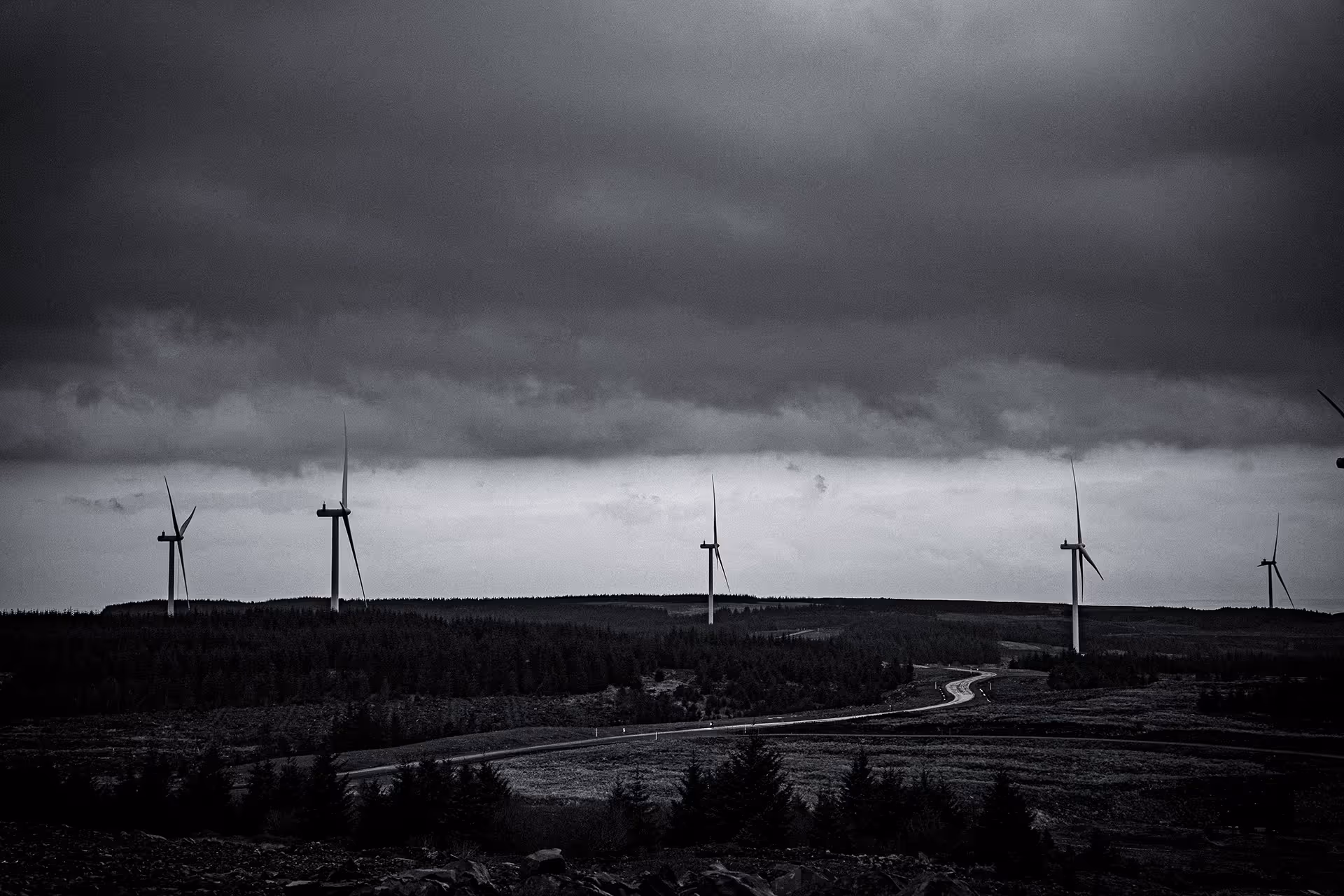
Beyond Forrest Estate, a short crossing of the A713 leads to a winding countryside road along Kendoon Loch, before rejoining the A713 for an 8km open road section. The road climbs gradually and purposefully. Ahead: windfarm territory.
.avif)
Into the Sky: Renewable Scotland and the Highest Point. KM 106–148
The public road falls away and the route pushes deep into windfarm territory. The turbines here are vast, turning calmly above you as you ride beneath them. This part of Scotland generates a significant portion of the country's renewable energy, and at this scale, you feel it.
The gravel beneath your wheels changes character entirely. These are gravel superhighways: wide, smooth tracks engineered to carry hundred-tonne transformers and turbine components. They make light work of a loaded gravel bike. The riding is fast and the views open wide across Ayrshire as the route climbs steadily upward.
The summit of Logan Hill in South Kyle Wind Farm marks the highest point of the entire route at over 500 metres. From here, a fast descent leads into North Kyle, a former open-cast coal site now mid-transformation. The land feels raw and partly healed, with FLS regeneration slowly reclaiming ground as the wind turbines turn overhead: a striking contrast between industrial past and renewable future.
The route then returns to classic forest gravel, threading back towards the northernmost point of the course. On a clear day, the coast near Ayr is visible in the distance.
Back to Earth: Craigengillan, Dalmellington and Loch Doon. KM 148–190
The route returns to public roads, reaching the town of Patna before a short circumnavigation leads directly to Feed Zone 2 at KM 152.4. From here, quick countryside roads drop towards Cloncaird Castle near Kirkmichael, though the route turns away before reaching it, ducking back onto gravel through quintessentially Scottish country lanes towards the former mining town of Dalmellington.
Turning off the A713 at Dalmellington, you arrive at the gateway to Craigengillan Estate: a 3,000-acre fold of British history, hidden between East Ayrshire's rugged hilltops. Once neglected, now transformed over two decades of careful restoration into a living landscape of native woodland, pasture, wetlands and loch. A living legacy of nature, history and human ingenuity.
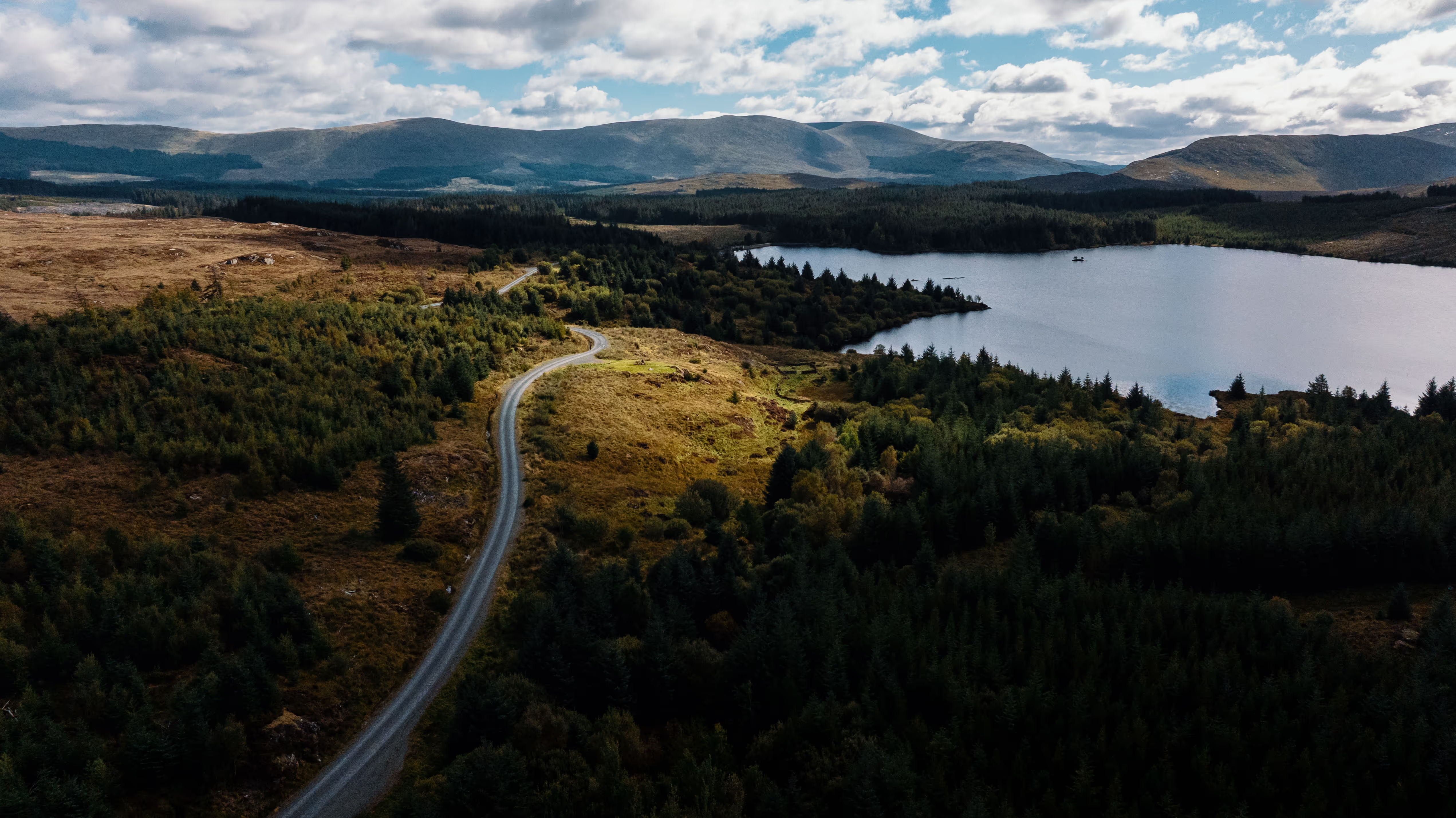
The estate gives way to public road, and Loch Doon reveals itself suddenly, its quiet surface wide and still. The single-track road is short-lived. Within moments, you are onto the start of a 40-kilometre near uninterrupted gravel stretch. The route rises high above the loch, the wilderness ahead unfolding in full. This is where the solitude begins in earnest.
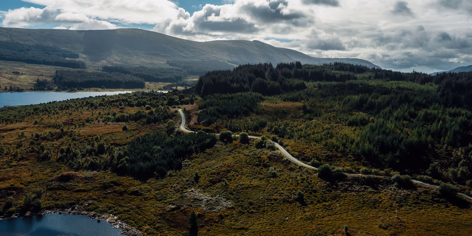
Into the Ayrshire Alps: Carrick Forest and the Village of Barr. KM 175–226
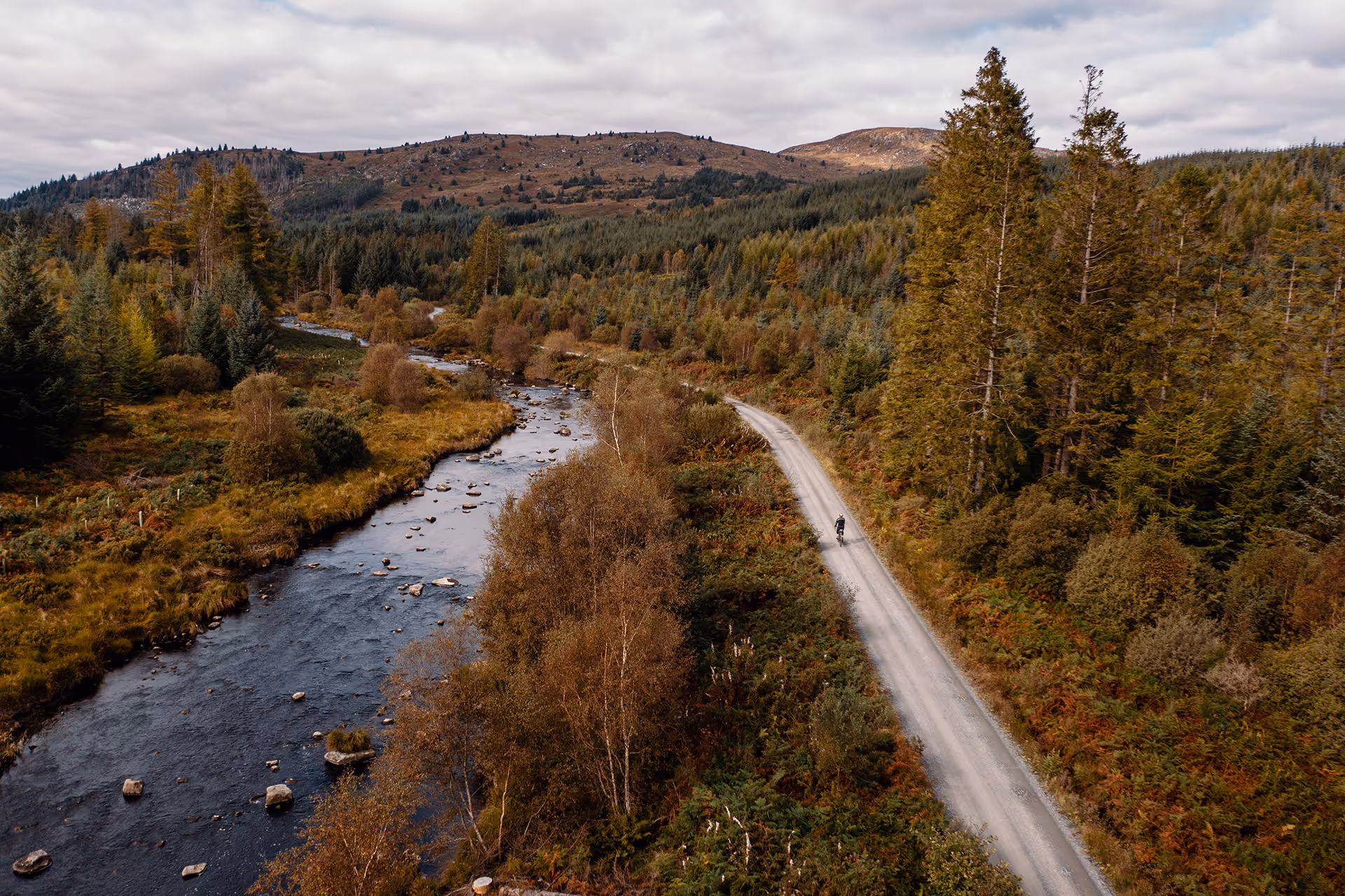
Carrick Forest Drive draws you deeper into the Galloway Forest Park, the gravel threading through dense forest past Loch Riecawr and climbing steadily to Loch Bradan. From here, a ridge line opens with views down the glen, a moment to take stock before the terrain reasserts itself.
The section ahead earns its name. The Ayrshire Alps is not a label given lightly: the terrain and the views begin to feel more akin to a central European mountain landscape than the rolling hills of southern Scotland. Deep glens, exposed ridgelines, long climbs — the route demands focus and rewards commitment. Glengap Hill and Haggis Hill lead you into deep woodland along the Laggan Burn, a descent that feels earned after everything that has come before.
At the end of it: Barr. A small, quiet, picturesque village and the location of Feed Zone 3. Stop properly. Eat. The next section is the most remote of the entire route, and the one that will stay with you longest.

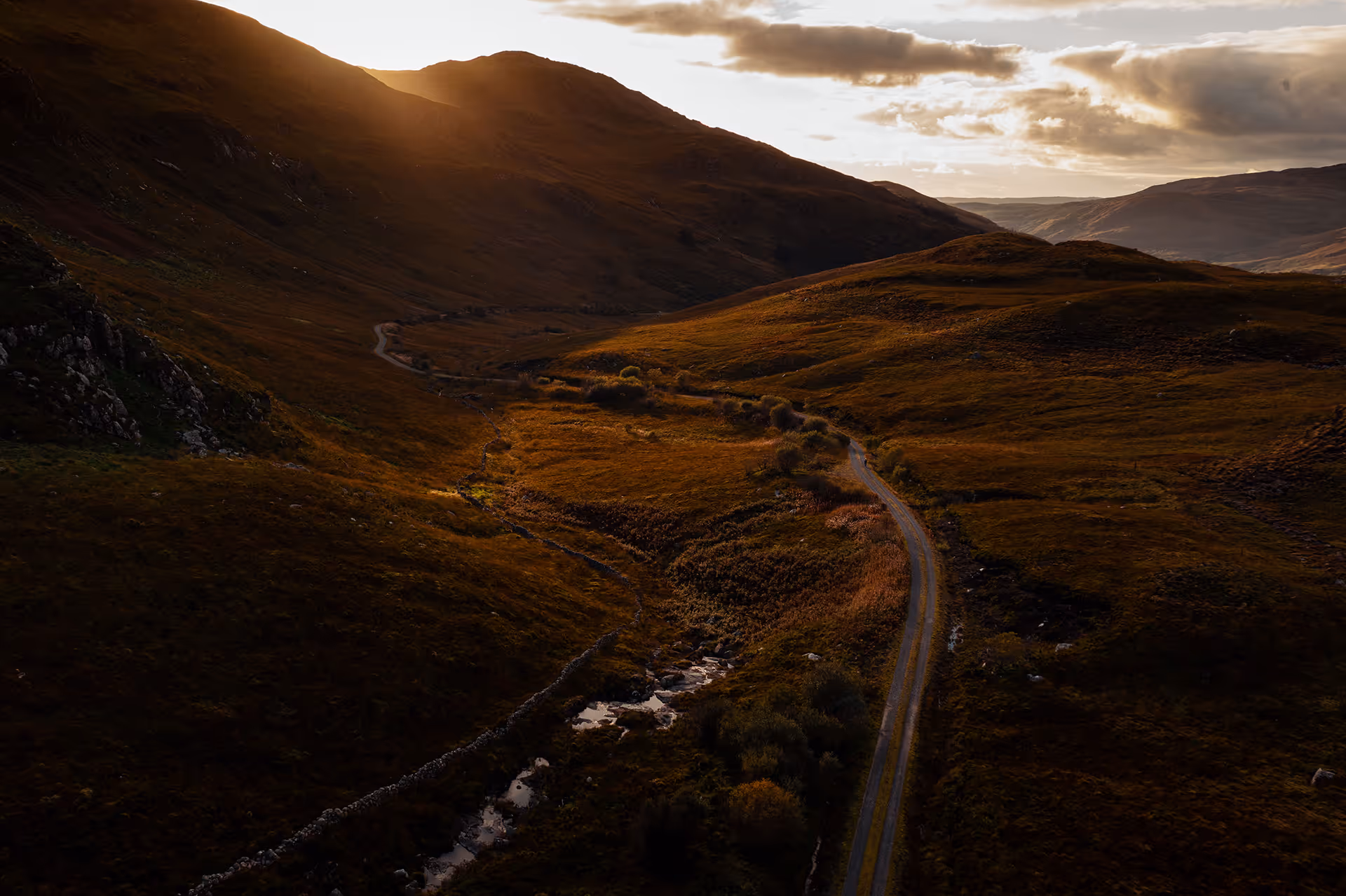
Into the Wild: The Remotest Ground. KM 227–295
This is the section that defines the Genesis Gralloch Ultra presented by Maxxis. Heading southwest from Barr, the public road disappears and the route enters the most remote wilderness of the entire course, threading through the southern reaches of Changue and Carrick Forest with little to no recorded activity on public heatmaps and almost no sign of civilisation for close to 50 kilometres.
The climb to Craiglaigh Hill lifts you onto a plateau adjacent to National Cycle Route 7, tracking past Loch Moan and onwards to Glentrool. For those riding into the evening and through the night, the Galloway Dark Sky Park announces itself here: the sky overhead fills with stars in a way that is genuinely difficult to describe to anyone who has not seen it.
Feed Zone 4 arrives at KM 272.4, the final resupply before the finish. Beyond it, the route passes the legendary Bruce's Stone, drops to the shores of Loch Trool, and climbs through Glentrool, a glen that holds its own at golden hour and deepens into something extraordinary in darkness. From here, the route crosses the pass towards Loch Dee, climbing to the final designated ascent at Clatteringshaws Loch before fast gravel returns you to The Queen's Way.
The Long Way Home: Loch Grannoch to Gatehouse. KM 296–323
A crossing of The Queen's Way signals the beginning of the end. The finish is within reach, but the route saves some of its best for last.
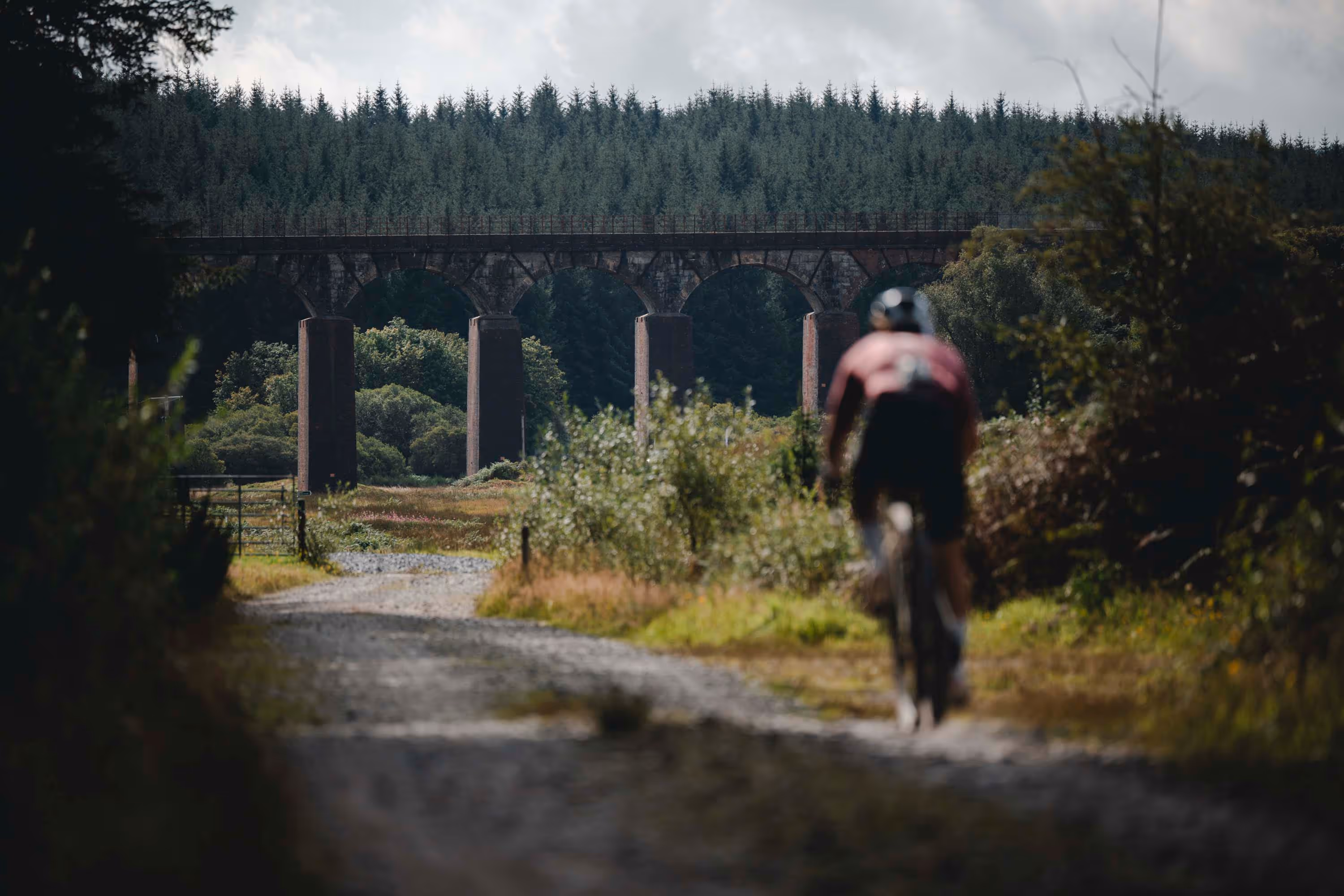
The final significant climb lifts you high above Loch Grannoch, the water spread wide and dark below, a view that arrives exactly when you need it most. A fast descent follows, carrying you down through the forest towards the Big Water of Fleet Viaduct: twenty granite arches built in 1861 as part of the Portpatrick Railway, now standing silent in the Cairnsmore of Fleet National Nature Reserve. It marks the end of the gravel. Ride underneath it slowly if you can.
From here, a final climb to Gatehouse Station, the site of the former railway halt, drops you onto the public road for a 10km descent back into Gatehouse of Fleet. The town that sent you off in the early morning hours is waiting to receive you. However long it has taken, whatever the hour, the finish is in Garries Park and it is yours.